
SIR CREEK ISSUE OVER THE DECADES
Nazia Azim
Independent researcher
Abstract: The origins of the Sir Creek dispute can be tracked back to the Partition Plan in 1947, leading to differing interpretations of the boundary lines. Subsequent wars and political differences between India and Pakistan have further complicated the negotiations surrounding this territory. In recent years, there have been sporadic instances of diplomatic talks aimed at resolving the Sir Creek issue. However, the inclusion of local stakeholders and environmental concerns has emerged as a key factor in the ongoing discussions. Furthermore, the Sir Creek conflicts avert the maritime cooperation between the two states which prevents the prosperity of the region.
Keywords: Partition Plan, Sir Creek, India, Pakistan, maritime disputes, sea, International Community
India and Pakistan are immediate neighbors with too many interests in common. In the not-so-distant past, the two countries that make up today’s two nations formed a large and magnanimous nation. They were both conquered by the United Kingdom under the English rule, formed the East India Company, founded in 1600. Both parties gained independence from the United Kingdom simultaneously in 1947 with the Partition Plan, marking the time when they became two separate independent states.
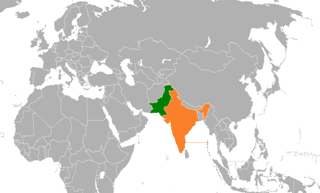
Pakistan, also known as the Islamic Republic, and India have a total of eight long-standing bilateral disputes; however, their regional disputes can be categorized into three main subcategories. Firstly, their most essential area of conflict concentrates in the region of Kashmir, which provoked three different wars in the 20th century: the 1948 war [1], one year after the Partition Plan, in 1965, and also in 1971.
These wars and many other disputes over the years provoked the already flammable situation, prompting New Delhi to develop nuclear power in 1998, causing Pakistan to defy the international restrictions and create its own atomic arsenal a few years later in 2005. The fact of the mutual developing nuclear arsenal drew the attention of the global Community and their fear of a nuclear confrontation. Secondly, the Kargil conflict, which focused on the Kargil district of Ladakh, led the international Community to once again focus on the Kashmir issue, as the Ladakh union territory is one of the two regions that concentrate the issue. In 1999, the Kargil war [1] evoked the complete intervention of the United States of America (USA), because in 1998-1999 India and Pakistan fought a war on the brink of nuclear war [1]. Although the intervention of the USA averted the atomic war, the nuclear tests by the side of India forced a settlement of the Kargil crisis without a complete solution to it. Thirdly, but as important as the other issues between Pakistan and India, comes the water issue. The Siachan glacier, the Sir Creek, the Tulbul, and at the same time, the issue of handling the resources of the Indus river made water a natural resource, which transformed their relations into a ‘battlefield’. As it is well known, water is a fundamental part of human life; however, governments around the globe see it as an essential tool for empowering their citizens. The issue of water resources resurfaced in 1948, when India cut off water supplies to Pakistan, which mainly relies on the Indus River for its water. Among the water issues involving Pakistan and India, the dispute over the Exclusive Economic Zone (EEZ) is also included.
This document will analyze the many parts of the Sir Creek dispute between the two countries, presenting some major issues of the 21th century is supporting that the only solution in the inte-regional issues can come from the solution that brings a water-originated point of view. Furthermore, the 21th century is providing a perfect horizon for its dissolve with the improtance it gives to the Blue Economy. Thus, taken a water-pointed orientation of the issues is concentrate to promote the Sir Creek dispute, as it is considering it as the foremost dispute between the two states.
Sir Creek’s water
Sir Creek, which was initially called Baan Ganga, renamed after a British surveyor during colonial mapping, is a fluctuating tidal inlet in the marshlands of the Indus River Delta that separates New Delhi from Islamabad. Sir Creek is 60 square miles (96 km) in area, it flows into the Arabian Sea. It separates the state of Gujarat in India from the Sindh province in Pakistan. It holds significant natural resources, such as oil and gas, and serves as a conduit for supplying the people of the two states. The prospects of finding natural gas in the vicinity hurried both parties to attempt to find a resolution about the Sir Creek boundary dispute on their own, without the intervention of the international Community, to enlarge as much as possible their respective Economic Zone [12]. However, their high expectations did not translate into their desires, which, sooner or later, will lead to international intervention if a major conflict breaks out in the region, as happened in 1965.
Sir Creek first arose as an issue between the governors of Kutch and Sindh in 1908, beginning over a pile of firewood on the Creek’s banks. In 1914, a settlement was reached through a compromise [4]. Later, under the Partition Plan, the Kutch region, now part of Gujarat, became part of India and the latter part of Pakistan, after the independence of India and Pakistan and the Resolution of the water crisis in 1948. However, under the international rule of Uti possidetis juris, which clearly states that a sovereign state, upon independence from a colonial power, must inherit the same borders as before, it seems that the independent states arising after the Partition Plan of 1947 inherited the right to the entire Sir Creek.
Even though the issue seemed to be resolved under the Roman rule, the Sir Creek dispute resurfaced in the 1960s. In April 1965, New Delhi and Islamabad fought a full-fledged war over the ‘conflict’ of Sir Creek. The erupted armed conflict in the area was temporarily halted with the pivotal agreement, which declared a ceasefire between the two states, established by the ‘The Indo-Pakistan Western Boundary Case Tribunal’ with the intervention of the international Community and the British Prime Minister, Harold Wilson. The international arbitration tribunal was formed to settle the border dispute in the Rann of Kutch. The court, by a 2-to-1 majority, issued an award that determined that almost 90% of the disputed territory went to New Delhi and the remaining 10% to Islamabad [4]. The tribunal’s decision, which settled the border along the Rann of Kutch, is widely considered a successful case of conflict resolution through international arbitration; however, it did not resolve the problem. The tribunal’s decision did not conclusively determine the hostilities over the resource-rich Sir Creek area.
The conflict dates back to the independence of the two countries in 1947. The Rann of Kutch, a desolate area of salt marshes, became a major contested boundary between India’s Gujarat and Pakistan’s Sindh province despite its long history through the 20th century. Nevertheless, although the international Community considers the arbitration a success in resolving a long-standing territorial dispute between the two neighboring countries, major papers on the Sir Creek region disagree with this assessment, as the issue remains unresolved to this day.
Although the 1968 Resolution, with the help of the British Prime Minister, is the latest Resolution on this dispute, Pakistan’s side does not accept it. Islamabad supports its positions by referring to the publicized Resolution of February 24, 1914, issued by the then Government of Bombay. Pakistan’s position is based on two contentions: the boundaries of the Creek must be demarcated in accordance with paras 9 and 10 of the Bombay Government Resolution, which was passed in 1914. Secondly, the demarcation of the maritime boundary must be preceded by the Resolution of the dispute over the Creek. The 1914 map shows a green line running along the eastern bank of Sir Creek on the Kutch side of the river as the boundary between Sindh and Kutch.

Pakistan still claims that the Sindh-Kutch boundary on the eastern bank of Sir Creek was delimited as part of a compromise under which the Government of Sindh would relinquish its claim to Kori Creek to acquire ownership of the entire Sir Creek boundary. It was also meant to be permanently fixed under the 1914 Resolution.
On the other hand, India, from its point of view, considers claims that the Thawlweg principle is the proper boundary in Sir Creek, and according to international law, claims that the red line is the real border of the two states, according to the Sir Creek issue, which, as of now, has surpassed one hundred years of dispute. Furthermore, it argues that Pakistan formally accepted and signed its position when, in a note of May 19, 1958, Islamabad admitted that the 1914 Resolution Map was no longer of use following the independence of the two states. And to support its stance on this matter, it argues that the green line Pakistan is referring to was only meant for symbolic representation of the issue.
For the analysts of this matter, the two stances are totally opposed. From Pakistan’s side, following the 1914 Resolution of the then Government of Bombay, Islamabad is justified in demanding the entire Creek, and, of course, all the resources found within its waters. India’s opinion on this matter is based on another map drawn in 1925, which depicted the river’s boundary as mid-channel.
Nevertheless, after the Partition Plan between the two states in 1947, these claims of Pakistan and India do not hold any logical basis, and today it seems even more utopian because it leads the researchers to another dimension.
Blue Economy/Blue Growth of the 21st century
The 21st century is not only the century of evolution in the Technological domain, like Artificial Intelligence, Cybersecurity, etc., but it is characterized as the century of Blue Economy and Ocean Civilization. The development of Economic globalization is urging the Land Industry, which had been the priority over the last centuries, to prioritize the Ocean Industry. The main objective of the Blue Growth is to control the utilization, maintenance, development, sustainability, protection, and last but not least the right exploitation of scarce blue resources/marine or coastal resources of each state that borders the Ocean or the Sea. Moreover, the term Blue Economy does not only include seas and oceans but also all the natural creations made by water.
Land resources in the 21st century are becoming even scarcer than in the past, which is one of the main reasons governments around the world are turning to the exploitation of the Blue resources of the globe. Those resources can be invaluable for elevating each state’s economic growth and supporting efforts to address the key financial problems and challenges related to sovereignty, security, development, access to food, and energy needs.
The Blue Growth Economy faces many challenges, as many economic activities use Blue resources. However, the main economic activities related to the blue growth economy are:
- Renewable Energy
- Fisheries and Food
- Maritime Infrastructure/Transport
- Tourism
- Energy
- Climate Change
- Mineral Resources
- Waste Management
Developing countries act as if the Blue Economy is of little significance, whereas developed countries are well aware of its potential and importance. Even though the significance of the Sea is already known to every state worldwide, some countries still cannot fully exploit and manage these natural resources effectively due to a lack of maritime awareness, excessive land disputes, and the simultaneous focus on these disputes. One of those developing states that have not received sufficient attention in the growth of the ocean economy is Pakistan, which, essentially due to a lack of awareness among government staff, misses out on its rights to the ocean.
To ensure maritime security, a nation needs maritime power. Maritime power means the military, political, and economic capability to use the Sea to secure one’s national objectives, while also being able to respond effectively to others seeking maritime power. Security in the marine domain encompasses activities to protect naval assets at Sea against counterattacks or intrusions by foreign countries. These assets include ports, shipping, fisheries, energy, and other resources. The lack of maritime security provides ample opportunity for a hostile power to infiltrate agents, arms, and ammunition for sabotage and terrorist activities. So, naval power is indispensable for security, commercial, and economic power.
Pakistan has a coastline of 1.046 kilometres, or about 650 miles. The maritime resources lie within its Ocean Economic Zone, within 200 nautical miles of its coast. The Continental Shelf, which lies within 350 nautical miles, may contain various resources. While India’s coastline has been revised to a new official length of 11,098.81 km, a significant increase from the previous figure of 7,516.6 km, due to a new, more detailed mapping and calculation methodology. This new measurement reflects the more intricate details of the coastline, including bays and inlets, and is the most current and official total figure for India’s maritime border. Reason for Change: The revised figure results from a new calculation methodology using more detailed maps at a larger scale (1:250,000), which capture more intricate coastal features than the previous, smaller-scale maps. The Andaman and Nicobar Islands have the longest coastline of any Indian entity, at 3,083.50 km. Maritime Zones: India also has a 12-nautical-mile territorial sea and a 200-nautical-mile exclusive economic zone (EEZ).
The maritime disputes
There are three maritime issues between India and Pakistan, but two of them surround the Sir Creek area. The first is the Sir Creek, one of the most enduring disputes between the two countries. The Resolution of this disagreement has sought three ways: the bilateral, the transnational, and the international, for at least a century now. The second one is about the fishermen, who follow the way the fish take.
Nature does not recognize any boundaries; it only follows its instincts, this leads them to cross their country’s borders, resulting in several years in jail and the confiscation of their boats. The prisoners on both sides face a violation of different international treaties, such as the Vienna Convention on Consular Relations and the India-Pakistan Agreement on Consular Access. The coastal communities of India and Pakistan, traditionally and economically interwined with the Sir Creek and surrounding areas, face the repercussions of territorial hostilities between the two countries. The geopolitical tension in the Sir Creek region is exacerbated by the effects of contemporary industrialization and climate change [9].
Although India and Pakistan have focused on the issue of Kashmir, the delimitation of the Line of Control (LOC) and the Siachen glacier, the importance of the Sir Creek, and the demarcation between the Sindh area and the Gujarat region have been minimized. However, in the century of the Blue Economy, which focuses on the protection and, at the same time, the exploitation of the Sea, the Sir Creek has gained another essential point in its Resolution. Nonetheless, that new point of view is out of the sight of the governmental staff of the countries, which leads them away from the point of today’s world, even though academics support the view that peace in Kashmir may be wrought at Sea [11].
The Convention on the Law of the Sea (UNCLOS) provides the rules and legal framework for all ocean affairs and governs the rights, duties, and jurisdictions in maritime zones. Both India and Pakistan are signatories to UNCLOS 1982, which provides a framework for their naval boundaries and related disputes. Despite ratifying the Convention, the countries have not resolved the disputed Sir Creek border, which is a significant point of contention and a source of ongoing political and economic tension. Pakistan formally contests India’s baseline system under UNCLOS principles, leading to continued disagreement on their maritime boundaries [10].
In 1982, both countries signed and ratified the UNCLOS treaty; India ratified it on June 29, 1995, and Pakistan on February 26, 1997. The contrast between the time when both countries signed the treaty and the years of ratification for the two countries showed their slow pace of government work and their hesitation in making decisions. As the main point of UNCLOS, the Convention on the Law of the Sea is highly relevant to the maritime relationship between the two states, especially concerning their still-to-be-resolved maritime boundary disputes; the most essential of these is the Sir Creek dispute. There are only two significant issues concerning the Sir Creek dispute that create the conflict zone. The first one is about the Boundary Delimitation: The precise location of the land terminus of the Sir Creek dispute is crucial because its Resolution directly impacts the delimitation of their maritime zones, including the territorial Sea and the exclusive economic zone (EEZ). The Economic Zone in this region is considered rich in oil, gas, and mineral resources, which increases the stakes of the ongoing conflict. The second one is Contravening Provisions: Pakistan has raised formal objections to India’s unilaterally declared straight baselines, arguing they contravene specific articles of UNCLOS (Article 7(4)) by using lengthy segments and including low-tide elevations without proper installations, and thus does not recognize India’s baseline system.
Even though both nations, as parties to UNCLOS, have access to its dispute settlement mechanisms, such as the arbitration tribunals under Article 287. However, political considerations and a preference for bilateral dealings (on India’s part) over third-party involvement (on Pakistan’s part) have so far hindered Resolution through these legal avenues. Although the Cooperation part seems more straightforward under the UNCLOS framework, which can facilitate cooperation in areas of mutual interest, such as the prevention and monitoring of marine pollution, the unresolved Sir Creek issue remains problematic between the countries.
The dispute is not just about a geographical border; it also affects fishing livelihoods, as the area is rich in fish. Pakistan officially disputes India’s baseline system, arguing that it violates specific UNCLOS articles and aims to maximize India’s internal waters, territorial Sea, and Exclusive Economic Zone.
Lack of Resolution focuses on the point that the dispute over this region was resolved in the 90s; the countries have not resolved the Sir Creek dispute, which has led to numerous arrests of fishermen from both countries and remains a thorny issue between Islamabad and New Delhi. The ongoing lack of Resolution in this area shows a lack of political will and a history of mistrust that have prevented a bilateral solution to the Sir Creek border.
Strategic Balance and Maritime Deterrence in the Northern Arabian Sea
Sir Creek’s significance lies not only in its history but in its location at the intersection of national security, maritime economics, and nuclear deterrence. For India, maintaining a credible presence along its western seaboard secures access to offshore energy infrastructure, protects trade routes, and supports broader regional initiatives such as Security and Growth for All in the Region (SAGAR). For Pakistan, the area links directly to its coastal defense network, supporting maritime traffic connected to the China–Pakistan Economic Corridor (CPEC) and the port of Gwadar.
The Pakistan Navy’s modernisation programme, including Hangor-class submarines and Type-054A/P frigates from China, enhances its sea-denial capability and complements China’s growing maritime footprint in the region. India’s own naval modernisation — represented by the INS Vikrant, Scorpène-class submarines, and forthcoming indigenous destroyers — reflects its determination to sustain maritime dominance and secure critical sea lanes. The parallel buildup of capabilities points to a regional naval competition centred not only on deterrence but also on influence and access in the northern Arabian Sea. Unlike previous decades, where deterrence rested on land forces, both countries now see the maritime domain as essential to projecting credibility and safeguarding economic interests. This shift illustrates how maritime strategy has become integral to broader national security architecture in both capitals.
Economic and Human Dimensions of a Strategic Waterway
While military manoeuvres dominate headlines, Sir Creek’s disputes have tangible human and economic consequences. The estuary’s surrounding seabed holds potential for oil and gas exploration, with both India and Pakistan having conducted surveys in adjoining maritime zones. The unresolved boundary, however, restricts commercial development and complicates potential bilateral investment in offshore resources. Fishing remains the most immediate and emotional issue for local populations. Hundreds of fishermen from both sides are arrested each year for inadvertently crossing the undefined maritime line — a humanitarian challenge that frequently strains diplomatic goodwill.
These arrests are compounded by harsh detention conditions and slow repatriation processes, though both governments periodically exchange prisoners through humanitarian initiatives. Environmental experts have raised alarms that repeated live-fire exercises and naval movements threaten the fragile mangrove ecosystems of the Rann of Kutch. These mangroves, vital to coastal stability and marine biodiversity, also support thousands of families dependent on fishing and salt production. Increased militarisation thus risks collateral economic damage to communities already living on the margins of a changing coastline.
Diplomatic Stalemate and the Nuclear Backdrop
Bilateral diplomatic mechanisms between India and Pakistan remain operational but under strain. The hotline between their Directors General of Military Operations (DGMOs) remains functional, yet the absence of new maritime confidence-building measures (CBMs) signals a decline in trust [2]. Agreements like the 1991 accord on prior notification of military exercises and the 2005 naval dialogue have not produced tangible progress in recent years. India continues to insist that border disputes, including Sir Creek, be resolved bilaterally under the framework of the 1972 Simla Agreement. Pakistan maintains that international maritime law, particularly UNCLOS, provides a legitimate avenue for third-party arbitration on technical boundary issues.
This divergence in approach has effectively stalled negotiations since 2012, when the last technical-level discussions were held. From a deterrence perspective, both sides’ development of sea-based nuclear platforms — India’s Arihant-class SSBNs and Pakistan’s Babur-3 submarine-launched cruise missile — adds a new layer of strategic complexity. While no evidence indicates active nuclear deployment in the Sir Creek region, the very existence of these capabilities underscores how misinterpretation in a maritime encounter could escalate rapidly. The challenge lies in ensuring tactical restraint within a deterrence framework that leaves little room for error.
A Narrow Corridor of Risk and Resolve
Sir Creek has transformed from an obscure colonial demarcation into a focal point of Indo-Pakistani maritime strategy. Both nations’ recent exercises are verifiable displays of readiness rather than direct provocations, yet their proximity raises the spectre of accidental confrontation. For India, sustained control over its western maritime approaches forms part of a broader strategy to safeguard national interests from the Arabian Sea to the Persian Gulf. For Pakistan, asserting a visible naval presence reinforces its sovereignty claims and demonstrates strategic endurance in a contested zone.
The unresolved nature of Sir Creek, however, means that each act of readiness carries with it the shadow of escalation. Diplomatic caution, disciplined communication, and professional restraint remain the only barriers preventing this narrow estuary from becoming a spark in South Asia’s enduring rivalry. As November’s drills conclude, Sir Creek remains a microcosm of the Indo-Pakistani equation — where geography, nationalism, and deterrence converge in a delicate balance that the region can ill afford to disturb.
Sir Creek also reflects the broader structural instability of South Asian security, where tactical events in confined geographies can rapidly assume strategic significance. The convergence of high-technology weapon systems, automated command networks, and compressed decision timelines makes the region increasingly vulnerable to misperception-driven escalation. Both militaries now operate in an information-saturated battle space where electronic warfare, surveillance, and cyber interference could distort situational awareness and trigger unintended responses.
In this environment, the absence of robust crisis-management frameworks or maritime confidence-building measures heightens the probability that even a routine patrol could be misread as a hostile act. Ultimately, Sir Creek exemplifies how unresolved maritime boundaries in the nuclear age demand not only deterrence but diplomacy informed by restraint, transparency, and technical dialogue to prevent the next crisis from beginning with a radar echo over a tidal swamp.
The Sir Creek issue remains a hot spot in the new millennium. The 21st century, with the importance that marine exploitation has gained and, simultaneously, the protection of it, is creating three new variables that did not have the same significance as they do today, given the 20th-century dispute in the region. First of all, the actual demarcation ‘from the mouth of Sir Creek to the top of Sir Creek’. Secondly, the exact demarcation from the top of Sir Creek eastward to a point on the line designated on the Western Terminus. And last but not least, the demarcation of the maritime boundary.
The two parties’ stances in the dispute differ, as conflicting opinions worsen the situation rather than improve it. On the one hand, India is averse to any third-party involvement in resolving any outstanding dispute with Pakistan. Meanwhile, Pakistan actively advocates third-party participation in resolving the Sir Creek and other territorial disputes with India. Still, it is denying its maritime boundary with India if the Sir Creek issue is not resolved. Under UNCLOS, if the two states failed to delimit their naval boundary by 2009, the International Seabed Authority could assume control over their continental shelf areas.
Although New Delhi and Islamabad had surveyed the 96km Sir Creek estuary, India’s delaying tactics have frustrated Pakistan’s attempts to resolve the issue. India proposed that the maritime boundary be demarcated in accordance with the technical aspects of the Law of the Sea (TALOS). However, Pakistan has completely rejected the proposal because the dispute must be resolved through arbitration before demarcation. In this issue, India has refused, contrary to international and British arbitration in the 20th century. As a result, India and Pakistan have not yet agreed on how the dispute will be solved if it is ever resolved.
Sir Creek in 2025
In the middle of 2025, specifically in May, relations between the two countries escalated. However, there was no full-fledged war like 1965; a three- or four-day armed conflict occurred, including military activity near the disputed Sir Creek region. The hostilities began after a terrorist attack on tourists in Pahalgram, an area of the India administered Kashmir, in April 2025, which killed 26 civilians. India accused Pakistan of supporting cross-border terrorist groups, something that Pakistan’s side denied, and also accused cross-border militant groups of the attack on the tourists in Pahalgram. As a result of that fact, the Indian government launched ‘Operation Sindoor’, a series of air strikes targeting terrorist groups and infrastructure in Pakistan and the Pakistan-administered Kashmir province. Precisely, India’s ‘Operation Sindoor’ targeted with missile strikes on terrorism-related infrastructure facilities of Pakistan-based militant groups Jaish-e-Mohammed and Lashkar-e-Taiba, and declared that no Pakistani military or civilian facilities were targeted. However, related to Pakistan’s stance, the Indian strikes hit civilian areas, including mosques, and resulted in civilian casualties. Following the strikes from the Indian side, there were border skirmishes and drone strikes between the two states. Pakistan’s army retaliated on May 7 by launching a blitz of mortar shells on Jammu, particularly Poonch, killing civilians and damaging homes and religious sites.
The conflict quickly escalated, leading to a situation between the two states. There were cross-border shelling, drone strikes, and aerial strikes, including more than 100 aircraft. The stance of both sides stemmed from targeting each other’s military installations, including air bases. This conflict marked the first drone battle between the two nuclear-armed nations, which resulted in the majority of countries around the world condemning the sudden escalation. However, on May 10, 2025, after a series of intense diplomatic engagements by the United States and other countries, the two states declared a ceasefire.
In 2025, the Sir Creek dispute escalated amid increased military activity and heightened rhetoric between New Delhi and Islamabad, particularly following India’s Operation Sindoor. Indian Defence Minister Rajnath Singh warned of a belligerent response to any ‘misadventure’ by the side of Pakistan around the disputed border. At the same time, both countries conducted live-fire exercises and issued overlapping airspace restrictions (NOTAMs) in the region.
After the May’s short conflict, especially in the Kashmir region, in October 2025, Indian Defense Minister Rahnath Singh issued a strong warning to Pakistan, citing that any aggression in the Sir Creek area would be met with a ‘resounding response’. The heightened tensions between the two countries were marked by simultaneous military exercises conducted just a few dozen kilometers apart. India has also conducted exercises in the region, such as the large-scale ‘Exercise Trishul 2025’, which involved tanks, fighter jets, and helicopters, which were developed in the area to deter potential incursions. The airspace restrictions included a period of heightened tension, during which both New Delhi and the Sir Creek sector issued overlapping Notices to Airmen (NOTAMs) restricting airspace in the area. NOTAMs are Notices to Airmen that contain time-sensitive information about temporary changes to aviation facilities, services, or hazards, such as runway closures, airspace restrictions, or military exercises.
The Sir Creek region, a disputed area, quickly became a focal point during the four-day conflict. Islamabad reportedly attempted to breach New Delhi’s defenses along the international border, including the vicinity stretching from Leh to Sir Creek. The region was highlighted as a possible flashpoint, and in the months after the May conflict, there were reports of Pakistan expanding its military presence in the area, prompting warnings from India’s Defense Minister. Although after the May conflict, there was an agreement to end hostilities, disputes over Sir Creek continue to this day. Pakistan’s recent expansion of military infrastructure in the adjacent areas is also a point of concern for India.
Conclusion
The disputed regions around Sir Creek remain active, with no formal dialogue held since 2012, and a significant erosion of mutual trust has prevented a resolution. The marshland is essential not just for territory, but because its demarcation determines the much larger maritime boundary and the associated Exclusive Economic Zones in the Arabian Sea, which are believed to contain valuable oil and gas reserves and rich fishing grounds.
The Sir Creek dispute reflects how history, geography, and politics continue to shape India–Pakistan relations. Though the area is mostly marshland, its proximity to the Arabian Sea, potential oil and gas reserves, and influence on maritime boundaries make it essential to both countries. Resolving this issue will require strong political commitment, trust, and regular dialogue between both countries, but the frequent tensions and security challenges have slowed the process. As the region looks toward peace and economic growth, Sir Creek remains a key test of cooperation and diplomacy between India and Pakistan in the modern era.
As the 21th century has been characterized as the century of the maritime domination, those who wants to concentrate on the disputes between Pakistan and India must begin from the issue of the Sir Creek, as it is hosted near the Arabian Sea where both states have major interests and future benefits. According to the evolution and the possible benefits that 21th century brings to the maritime region it is the right time for the two countries to hold away of their grudges and observe their future as two states that have enormous possibilities over in an almost unexplored part of the Earth as it is the vicinity of the Arabian Sea.
REFERENCES
- 1.Shantonu Roy (2016). Indo-Pakistan Tensions: Conflict or Cooperation
2. Admiral Hasan Ansari, Admiral Ravi Vohra. Confidence Bulding measures at Sea, Opportunities for India and Pakistan
3. Baber Ali (2022). Indo-Pak Maritime Relations and a proposal joint fishery regime: A human rights perspective
4. Jose M. Gonzales (2023). Bridges from the sea: Maritime confidence-building measures between India and Pakistan
5. Ali, Muhammad (2012). Maritime issues between Pakistan and India: seeking cooperation and regional stability
6. Rashid Ahmad Khan. Sir Creek: The origin and development of the dispute between Pakistan and India
7. Sudhakar Tyagi (2016). India’s Border Management with Pakistan: An analysis
8. Krishna Nand Shukla (2016). Indo-Pak Relations: An Overview
9. Akshat Gogna, Neha Das (2025). Mitigating the India-Pakistan Maritime, Humanitarian, and Environmental Adversities with respect to Sir Creek
10. United Nations Convention on the Law of the Sea
11. Ali, Muhammad. Maritime issues between Pakistan and India: seeking cooperation and regional stability
12. Mushtaq Ahmad Mir, P.hd Political Science, India-Pakistan; The History of Unsolved Conflicts
